THE 2014 ELECTRICAL RESISTIVITY SCANS
In late 2014, the Turkish government granted permission to John Larsen from New Zealand, to scan the buried remains of this boat shaped object, using the latest deep penetration Electrical Resistivity Tomography (ERT) ground imaging technique.
The entire work of scanning the Ark took nearly three weeks. During this time the other members of the team remained at the hotel, until all of the scanning work was completed by John Larsen with the assistance of Randall Lee.
Ten longitudinal scans were accomplished, where each scan covered the entire length of the ship. Then three additional cross section scans were performed which included the ground around the ship. (Fig. 7). All of the data was then compiled into a 3d file and combined with the topographic survey results which John Larsen processed using the latest EarthImager 3d software.
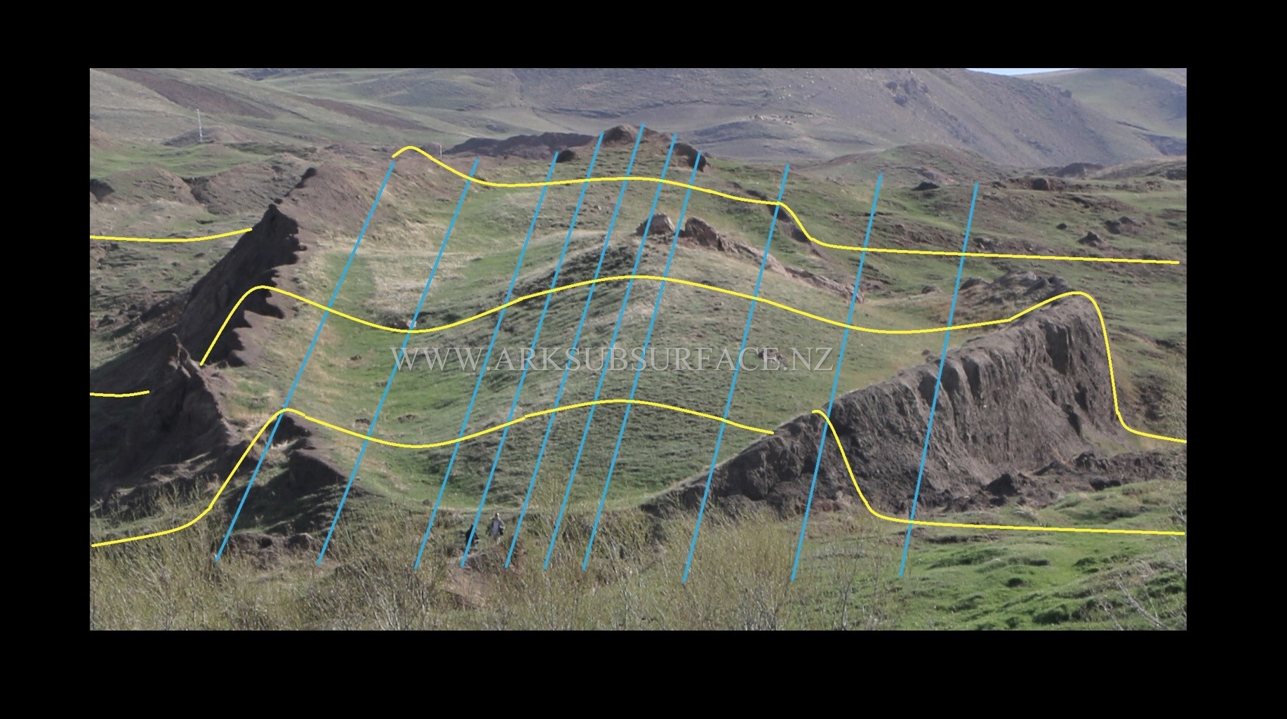
Fig. 7. The Layout of the Resistivity Scans.
Resistivity imaging is a technique that was developed during the 1920's, for deep oil and mineral exploration. The data obtained from a resistivity scan contains hundreds of individual measurements of the resistance of the subsurface ground material at different positions and depths, without the need for excavation.
Different materials have different electrical properties. Any variations in the composition of the material beneath the ground, can be identified by the resistivity of each of the materials and the change in resistivity at the boundaries between two different materials. The results are then displayed using a specific colour for each level of resistivity on the images that are produced. (Fig. 8).
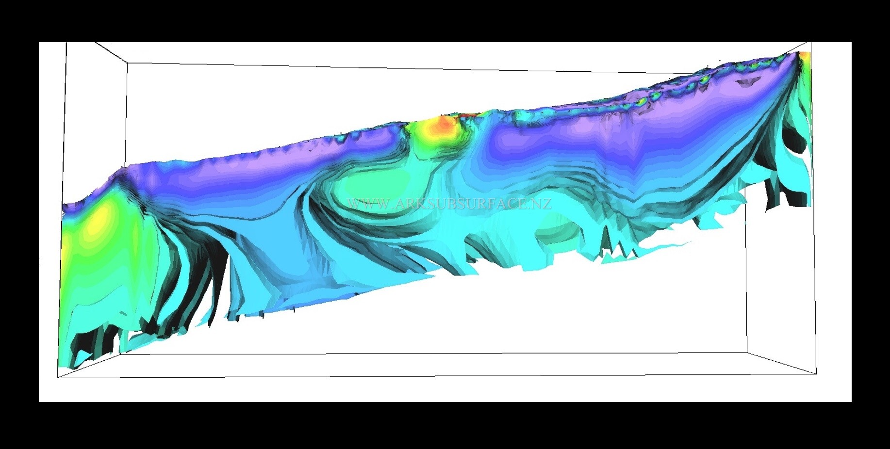
Fig. 8. An image of the Ark showing the variation in resistivity throughout the ship and the ground around it.
The first image penetrated 34.8 metres below the ground, which is well beyond the 8 metre range of the radar scans. This image verified that the boat shaped outline of the hull that is seen above the ground, also continued beneath the ground and had the shape of a gigantic ship. (Fig. 9).
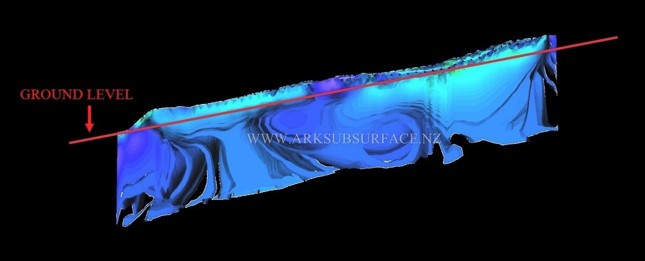
Fig. 9. The right side scan of the Ark, showing the position of ground level.
When the hull shape is viewed in three dimensions, the resistivity images show that the front section which lies beneath the ground, resembles the form of a ship which has the shape of a deep hull design. (Fig. 10).
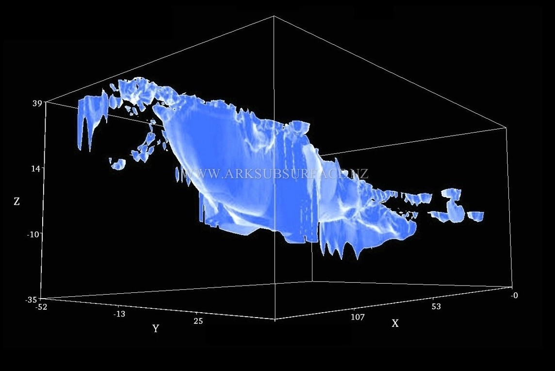
Fig. 10. The 3D View of the Front of the Ark.
NEXT PAGE: THE THREE INTERNAL DECKS